New series installment
California's Largest Lake Was an Accident: The Salton Sea Story
By JC Pacific Corp Published October 7, 2026 California, Did You Know?, Edition 1
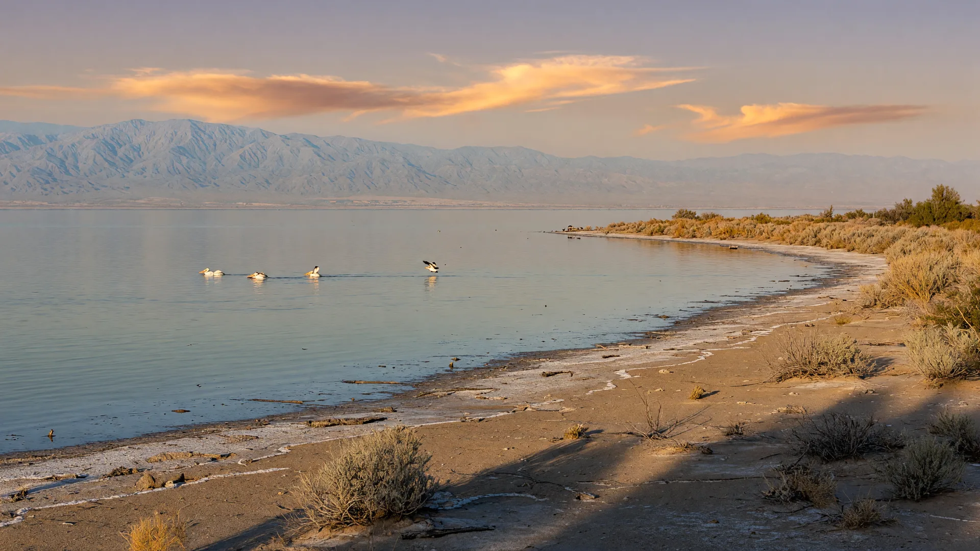
California's largest lake by surface area was not carved by glaciers, planned by engineers, or filled by a dam. The Salton Sea was created by accident between 1905 and 1907, when the Colorado River broke through an irrigation canal and poured into a dry desert basin for about 18 months. The result is a shallow, salty lake roughly two-thirds larger than Lake Tahoe by surface area, sitting about 236 feet below sea level, and now essential to one of the most important bird habitats in the western United States.
Quick facts
1905-1907
Years the Colorado River poured into the basin before crews closed the break
~318 sq mi
Surface area at recent water levels, the largest lake in California by area
~236 ft
How far below sea level the lake surface sits (USGS, 2018)
400+
Bird species documented at the sea, a critical Pacific Flyway stopover
150-160 mi
Distance from Los Angeles, roughly a 2.5 to 3 hour drive
How did the Colorado River accidentally create a lake?
In the early 1900s, developers wanted to farm the Imperial Valley, a stretch of Colorado Desert that gets almost no rain but sits on some of the most fertile soil in the country. To get there, they needed Colorado River water, so the California Development Company built the Alamo Canal, a diversion channel that carried river water toward the valley. The canal opened around 1900 and 1901, and the project was, by most accounts, rushed and fragile at the point where it met the river.
In the winter and spring of 1905, heavy rain and snowmelt swelled the Colorado far beyond normal. Floodwaters surged over and around the canal's intake gate, and by late November 1905 the river was running down the New River and the Alamo River into the Salton Sink, a vast dry basin below sea level. What had been farmland became a growing inland sea almost overnight. Crews tried again and again to close the gap; the river kept reclaiming it.
It was not until February 1907, roughly 18 months after the flood began, that workers finally stopped the flow. By then the basin held the lake that is still on the map today: the Salton Sea.
The short answer: no one planned the Salton Sea. A flooding river filled a below-sea-level basin, the water stayed, and a new lake appeared on California's maps.
Is the Salton Sea really the largest lake in California?
By surface area, yes. At recent water levels the Salton Sea covers about 318 square miles, compared with Lake Tahoe's roughly 191 square miles. That makes it the largest lake in California by area, a fact that surprises almost everyone, because the two lakes could not look more different. Tahoe is a deep alpine lake ringed by granite peaks; the Salton Sea is a shallow salt lake ringed by desert.
The caveat is that "largest" depends on how you measure. Tahoe is far deeper and holds far more water. But if the question is which California lake covers the most surface, the answer is the Salton Sea, a lake that did not exist a little over a century ago.
Salton Sea
About 318 sq mi
Shallow, salty desert lake about 236 feet below sea level
Lake Tahoe
About 191 sq mi
Deep alpine freshwater lake in the Sierra Nevada
Why is a California lake sitting below sea level?
The Salton Sea sits in the Salton Sink, the floor of an ancient lake basin called Lake Cahuilla. Over the centuries, the Colorado River has shifted course across the region many times, and each time it wandered into this basin, a lake formed; when it shifted away again, the lake dried. The 1905 flood simply filled the bowl once more, this time in front of railroads, farm towns, and newspapers.
What keeps the basin below sea level is geography, but what keeps the lake salty is physics: the Salton Sea has no outlet. Water arrives and can only leave by evaporation, and evaporation leaves the dissolved minerals behind. The sea has grown saltier every year since, a fact that shapes everything about its future.
What happened next: resorts, runoff, and the birds
For a while, the accidental lake was a destination. Shoreline communities grew on its beaches, and in the 1950s places like Bombay Beach were resort towns where people boated, fished, and relaxed by the water. That era faded as the water grew saltier and the sea's condition declined, and today several of those towns are quieter, stranger versions of what they once were, now known for art installations and the desert landscape around them.
The sea today is fed largely by agricultural drainage from nearby farmland. That water carries salts and nutrients, which fuel algae growth; when the algae break down, oxygen can drop, and the lake's chemistry becomes stressful for fish. Water levels fluctuate as inflows decline, the shoreline can smell of sulfur during warm stretches, and managing the sea has become one of California's most complicated environmental problems.
Here is where the story turns. More than 95 percent of California's historic wetlands have been lost, so the Salton Sea has become a vital stopover and wintering site on the Pacific Flyway, the migratory highway that runs from Alaska to Mexico. More than 400 bird species have been documented here. In winter the sea is crowded with snow geese, Ross's geese, ducks, and shorebirds, and year-round residents include the endangered Yuma Ridgway's rail. An accidental lake that almost nobody wanted has become an accidental refuge that millions of birds depend on.
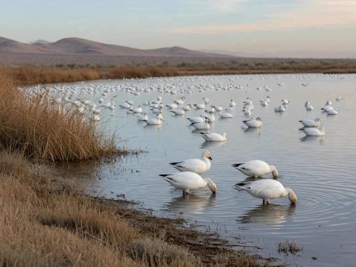
Winter waterfowl at a Southern California desert wetland. From November through February, the Salton Sea hosts large numbers of migrating and wintering birds.
Can you visit the Salton Sea? What to know before you go
Yes, and a visit is one of the most unusual day trips Southern California offers, especially between late fall and early spring, when temperatures are mild and the birds arrive. It is not a beach day, so go with the right expectations: bring water, a hat, sunscreen, and binoculars, and expect birding, art, and desert scenery rather than swimming.
Where to go
- Sonny Bono Salton Sea National Wildlife Refuge: a free, public refuge on the southern end of the sea near Calipatria, with trails, photo blinds, and an observation tower. It is one of the top birding spots in the West; the visitor center at 906 W Sinclair Rd typically opens during the winter season, so check the U.S. Fish & Wildlife Service refuge page or call (760) 348-5278 before you go.
- Bombay Beach: the lowest community in the United States, about 223 feet below sea level. Once a 1950s resort town, it is now known for its art installations, its working dive bar the Ski Inn, and the odd, photogenic contrast of bright color against the desert and the sea.
- Salvation Mountain: a free folk-art landmark near Niland, built over decades by Leonard Knight. The painted adobe hill stands about 50 feet tall and 150 feet wide and is open dawn to dusk year-round; see salvationmountain.org for visiting details.
- Coachella Valley date farms: on the way out, near Indio, about 95 percent of the dates grown in the United States come from the Coachella Valley. Shields Date Garden, established in 1924, offers a free garden walk and its famous date shakes, and other farm stands line the route.
Getting there and practical notes
- The sea is about 150 to 160 miles from Los Angeles, roughly a 2.5 to 3 hour drive via I-10 and Highway 86 or 111, and about 60 miles from Palm Springs and the Coachella Valley.
- Plan for late fall through early spring. Summer temperatures in the basin are extreme, and the shoreline can carry a sulfur smell during warm spells.
- Bring water, snacks, and binoculars. Services are spread out, so treat it like a desert trip even though it is only a few hours from the city.
Why should you care about the Salton Sea?
The Salton Sea is a good reminder that California does not fit into a postcard, and that is the point. A canal that failed became a lake. A lake that fell apart became a refuge. Today the sea sits at the center of a genuine restoration effort: state and federal agencies, conservation groups, and local communities are working on projects to manage water, stabilize shoreline, and protect habitat, while the birds keep showing up every winter as they have for more than a century.
For a closer look at the science and the stakes, the Audubon California Salton Sea project and the Salton Sea entry in the Encyclopaedia Britannica are good starting points. And if you would rather see it in person, the route from Los Angeles or the Coachella Valley makes a memorable weekend loop with Joshua Tree National Park just to the north.
A starting point, not a lecture
This story is a starting point for your own visit or your own reading. Bird populations, refuge hours, water levels, and restoration work all change, so confirm current conditions with official sources such as the U.S. Fish & Wildlife Service before you travel.
Salton Sea questions, answered
How was the Salton Sea created?
In 1905, floodwaters from the Colorado River broke through the intake of the Alamo Canal, an irrigation canal built for the Imperial Valley, and ran down the New and Alamo Rivers into the Salton Sink, a dry basin below sea level. Crews did not fully close the breach until February 1907, about 18 months after the flood began, and the water that remained became the Salton Sea.
Is the Salton Sea the largest lake in California?
By surface area, yes. At recent water levels the Salton Sea covers about 318 square miles, compared with Lake Tahoe’s roughly 191 square miles. Tahoe is far deeper and holds far more water; the Salton Sea simply spreads across more surface area.
Why is the Salton Sea below sea level?
It sits in the Salton Sink, the floor of an ancient lake basin called Lake Cahuilla that filled and dried repeatedly as the Colorado River shifted its course over centuries. The lake surface today sits about 236 feet below sea level.
When is the best time to visit the Salton Sea?
Late fall through early spring is the most comfortable window, and November through February is the best birding season, when snow geese, Ross’s geese, ducks, and shorebirds winter at the sea. Summer heat in the basin is extreme.
Is the Salton Sea safe for swimming?
A visit here is not a typical beach day. The water is very salty, algae and water conditions change through the year, and local conditions and advisories can vary. Most visitors come for birding, art, and the desert landscape; check current conditions with the refuge or local authorities before getting in the water.
How far is the Salton Sea from Los Angeles?
The sea is about 150 to 160 miles from Los Angeles, roughly a 2.5 to 3 hour drive on I-10 and Highway 86 or 111. It sits about 60 miles from Palm Springs and the Coachella Valley, and Bombay Beach is about 40 miles south of Indio.
California has a way of making it easy to imagine staying awhile, and places like the Salton Sea are part of the reason: the state keeps surprising even its own residents. If you are thinking about making California home, the JC Pacific team would be happy to help you explore what that could look like, from the coast to the desert. Come back next month, when the next edition of California, Did You Know? brings another story worth knowing.
Return to the series
Come back for the next edition of California, Did You Know?
One installment lands each month, each one built around a surprising but true story about California and Southern California living. If a place, a fact, or a hidden gem has always made you wonder, tell us: your idea could become a future edition.
Facts, figures, and visitor details in this installment were checked against public sources at publication time. Stories in this series are written for education and enjoyment; they are not legal, tax, lending, or investment advice.